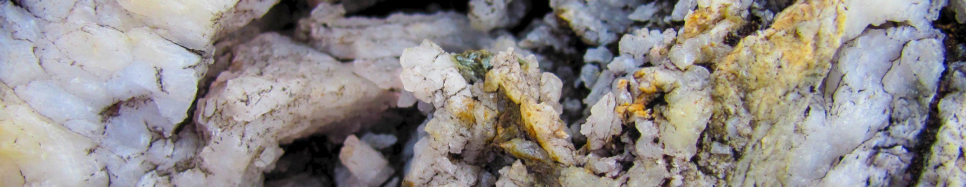
Vancouver, British Columbia – Auramex Resource Corp. (the “Company” or “Auramex”) (TSX.V: AUX) reports that permitting on its Georgie River project is on track to conduct drilling this summer. The project is located on tidewater in the southern Golden Triangle, 16 km south of the deepwater port of Stewart. The 100% owned 7,936 hectare project includes the historic Georgia River Mine, a high-grade gold mine that last operated in the 1930s (Click here for a location map).
The Auramex geological team has assembled compelling evidence for the presence of a large-scale gold bearing system underlying and peripheral to the historic mined area. That system is analogous to the geological systems that host other large gold deposits in the prolific Golden Triangle. This current interpretation is based on integrating data from more than 100 years of exploration and production history with the results of a decade of work by Auramex. Work in the 1970s through the 1990s focused on the area of the old mine and included 114 shallow drill holes, leading to a 1990 estimate of remaining tonnage and grade within and immediately adjacent to the old workings (276,400 tonnes of 27.6 gm/t gold and 20.9 gm/t silver). The estimate stated is in an historic report, is non-compliant with National Instrument 43-101 and has not been verified by the Company; readers are cautioned not to place undue weight on such results. The historical estimates are considered relevant; however, the reliability, assumptions, parameters and methods used in preparing the reports are unknown.
More recent and far more widespread exploration by Auramex has confirmed that the area of the high-grade historic mine is merely one small near-surface expression of an extremely large gold-bearing hydrothermal system. Mapping to the southwest of the mine located a 750 m-wide, southwest-dipping zone of shearing (the Hume Creek Deformation Zone or HCDZ), an order of magnitude wider than similar shear zones in the mine. An airborne versatile time-domain electromagnetic (V-TEM) survey identified a 1 km2 area of anomalously high electromagnetic response over the HCDZ along the ridge crest. This is interpreted as an area of anomalously high conductivity. Elevated EM responses persist down the steep, forested sides of the ridge, albeit muted by the higher terrain clearance required there for safe operation of the survey (Click here for GR-HCDZ geophysical map).
Dr. Paul Metcalfe P.Geo., the Company’s Vice President of Exploration noted: “Six years ago, as an independent QP, I assessed the Georgie River project as being ‘of exceptional merit’. New findings have further strengthened my opinion of the project. Georgie River lies at the roots of an ancient (Early Jurassic) volcano, whose intrusions carry anomalous gold concentrations. That volcano is located at the intersection of deep faults in the ancient crust of the Golden Triangle. Most importantly, the regional, southeast-trending Sovereign Fault was active during and after volcanism, creating a massive conduit for the fluids which dissolved, transported and deposited the gold. In my experience, the half-kilometre-plus width of this plumbing system is unprecedented. For its stage of development, this is the most prospective project I have seen – and it is the reason I am a significant shareholder of Auramex.”
Inversion of these geophysical data indicated a blind conductive target coincident with the southwest-dipping Sovereign Fault at the core of the HCDZ. The projected surface trace of this fault had been sampled in 1990 over a strike length of 590 m, returning values of 1 gm/t Au or higher from surface or near-surface samples. Exploration in 2018 confirmed the local occurrence of massive arsenopyrite containing gram-plus values of Au along the fault. The Sovereign Fault has been traced, using Synthetic Aperture Radar, from tidewater across the ridge to the project’s southern boundary, roughly 10 km to the south. It is interpreted as a regional structure of considerable size, active at the time of mineralization and a probable conduit for an extremely large gold-bearing Early Jurassic hydrothermal system. Other than the 590 m section at the ridge crest, the Sovereign Fault and its blind conductive target is untested by surface sampling or drilling.
Phase I exploration planning is currently underway and the data collected will be used to refine drill targets for Phase II. The data collected will also increase understanding of the conductivity anomaly, including its extent and possibly structural controls as they relate to mineralization of the very large hydrothermal system at Georgie River. Plans include geochemical surveying (endogenic and exogenic) and a deeply penetrating ground based geophysical survey over the HCDZ.
The technical disclosure in this release has been read and approved by Dr. Paul Metcalfe, PhD, P.Geo., a qualified person as defined in National Instrument 43-101.
About Auramex Resource Corp.
Auramex is focused on exploring a
large and highly prospective property portfolio in the Stewart camp, at the southern
end of the Golden Triangle in British Columbia. Auramex has 200 square kilometres of
mineral rights, located on or near roads and within 45 kilometres of the deep-water
port of Stewart. The Company’s geological team has extensive knowledge in the Golden
Triangle and are dedicated to maximizing exploration success by deploying a
systematic and comprehensive exploration approach, that uses and fuses “traditional”
and emerging, cutting-edge exploration techniques.
On behalf of the Board of Directors:
Lawrence Roulston
President & CEO
For further information, contact:
Nancy Curry
VP Corporate
Development
info@auramex.com
www.auramex.com.
Neither the TSX Venture Exchange nor its Regulation Services Provider (as that term is defined in the policies of the TSX Venture Exchange) accepts responsibility for the adequacy or accuracy of this release.